get_map
Helpfully, there's just one function that will allow you to query Google Maps, OpenStreetMap, Stamen maps, or CloudMade maps: get_map in the ggmap package. You could also use either get_googlemap, get_openstreetmap, get_stamenmap, or get_cloudmademap, but instead you can just use get_map for the same functionality as all of those combined. This makes it easy to try out different basemaps for your data.You need to supply get_map with your location data and the color, source, maptype, and zoom of the base map.
Let's go ahead and map the trails in Elwyn John Wildlife Sanctuary here in Atlanta. The csv data and R file are available in a gist.
gps <- read.csv("elwyn.csv",
  header = TRUE)

library(ggmap)
mapImageData <- get_map(location = c(lon = mean(gps$Longitude),
  lat = 33.824),
  color = "color", # or bw
  source = "google",
  maptype = "satellite",
  # api_key = "your_api_key", # only needed for source = "cloudmade"
  zoom = 17)

pathcolor <- "#F8971F"

ggmap(mapImageData,
  extent = "device", # "panel" keeps in axes, etc.
  ylab = "Latitude",
  xlab = "Longitude",
  legend = "right") +
  geom_path(aes(x = Longitude, # path outline
  y = Latitude),
  data = gps,
  colour = "black",
  size = 2) +
  geom_path(aes(x = Longitude, # path
  y = Latitude),
  colour = pathcolor,
  data = gps,
  size = 1.4) # +
# labs(x = "Longitude",
#   y = "Latitude") # if you do extent = "panel"
We'll be changing the four lines marked above in orange to change what basemap is used.
source = "google"
get_map option source = "google" (or using get_googlemap) downloads a map from the Google Maps API. The basemaps are © Google. Google Maps have four different maptype options: terrain, satellite, roadmap, and hybrid.source = "google", maptype = "terrain"
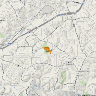 |
| source = "google", maptype = "terrain", zoom = 14 |
source = "google", maptype = "satellite"
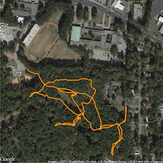 |
| source = "google", maptype = "satellite", zoom = 17 |
Max zoom: 20
source = "google", maptype = "roadmap"
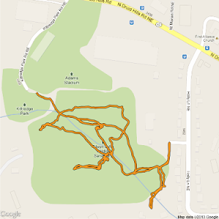 |
| source = "google", maptype = "roadmap", zoom = 17 |
source = "google", maptype = "hybrid"
Hybrid combines roadmap and satellite.
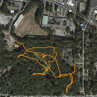 |
| source = "google", maptype = "hybrid", zoom = 17 |
Max zoom: 20
source = "osm"
get_map option source = "osm" (or using get_openstreetmap) downloads a map from OpenStreetMap. These maps are Creative Commons licensed, specifically Attribution-ShareAlike 2.0 (CC-BY-SA). This means you are free to use the maps for commercial purposes, as long as you release your final product under the same Creative Commons license. OpenStreetMap has no maptype options.source = "osm" (no maptype needed)
source = "stamen"
get_map option source = "stamen" (or using get_stamenmap) downloads a map from Stamen Maps. The map tiles are by Stamen Design, licensed under CC BY 3.0. The data for Stamen Maps is by OpenStreetMap, licensed under CC BY SA. Stamen has three different maptype options: terrain, watercolor, and toner.
source = "stamen", maptype = "terrain"
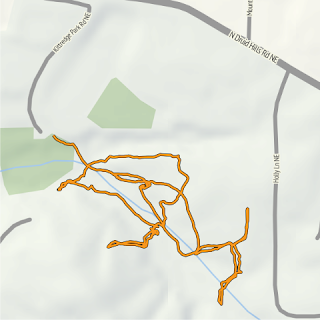 |
| source = "stamen", maptype = "terrain", zoom = 17 |
Max zoom: 18
source = "stamen", maptype = "watercolor"
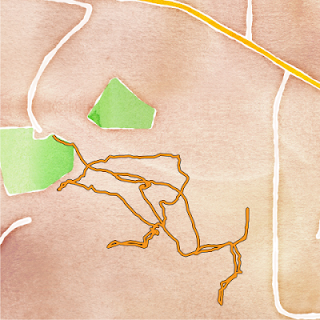 |
| source = "stamen", maptype = "watercolor", zoom = 17 |
Max zoom: 18
source = "stamen", maptype = "toner"
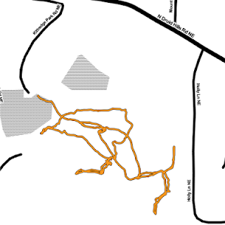 |
| source = "stamen", maptype = "toner", zoom = 17 |
Max zoom: 18
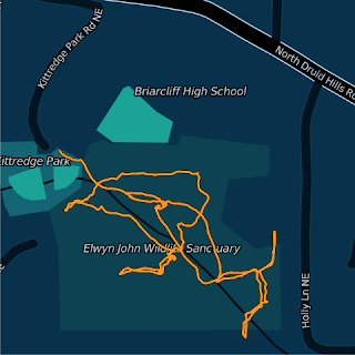
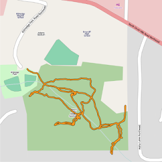
source = "cloudmade"
CloudMade styles build on top of OpenStreetMap data. Thousands of CloudMade styles are available. You can browse them on the CloudMade site. You can also make your own styles.To use CloudMade map styles in R, you will first need to get an API key to insert into your R code so it can access the maps. You can get an API key from the CloudMade site.
Here are just a couple examples of CloudMade basemaps:
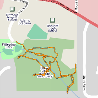 |
| source = "cloudmade", maptype = 1, api_key = "your_key_here", zoom = 17 Style: The Original Author: CloudMade |
 |
| source = "cloudmade", maptype = 67367, api_key = "your_key_here", zoom = 17 Style: 10Scape-2 Author: Romeady Adi |
library(ggmap)
ReplyDelete> mapImageData <- get_map(location = c(lon = mean(gps$Longitude),
+ lat = 33.824),
+ color = "color", # or bw
+ source = "google",
+ maptype = "satellite",
+ # api_key = "your_api_key", # only needed for source = "cloudmade"
+ zoom = 17)
Error: internal error -3 in R_decompress1
In addition: Warning message:
restarting interrupted promise evaluation
I am getting this error.can anyone tell me what could be the reason?
Maybe start a new session and try again? And if that doesn't work, maybe try updating your packages. I'm not sure, though.
ReplyDelete